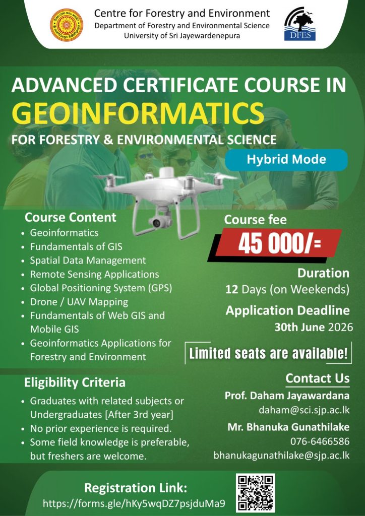
Join the Advanced Certificate Course in Geoinformatics for Forestry & Environmental Science conducted by the Centre for Forestry and Environment, University of Sri Jayewardenepura.
✅ GIS & Spatial Analysis
✅ Remote Sensing Applications
✅ GPS & Drone Mapping
✅ Web GIS & Mobile GIS
✅ Hands-on Practical Training
✅ Hybrid Learning Mode
📅 Application Deadline: 30 June 2026
🎓 Limited Seats Available!
Take the next step toward a career in geospatial technology, environmental management, and spatial data science.
#Geoinformatics #GIS #RemoteSensing #DroneMapping #UAVMapping #SpatialAnalysis #WebGIS #GPS #EnvironmentalScience #Forestry #Geospatial #GISTraining #ArcGIS #QGIS #GeoSpatialTechnology #Mapping #Surveying #SriLanka #UniversityOfSriJayewardenepura #ProfessionalDevelopment #CareerGrowth #Geography #DataScience #GeoEducation #GISCommunity #LearnGIS #GeospatialEducation #GISSriLanka #EnvironmentalManagement #FutureReadySkills 🚀🌏