The name “Thoppigala” became so popular in recent years due to the salvage operation carried out by the Sri Lankan Army in the path of eradicating the terrorism from Sri Lanka. But other than that, most do not know the significant and ancient facts about this locale.
Recently Prof M. W. Wimal Wijeratne of University of Sri Jayawardenepura has published a more interesting research about Thoppigala.


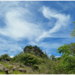
Thoppigala is located in Batticaloa District. It is also known as Baran’s Cap and Kudumbimalai. Kudumbimalai inTamil translates to Hair-knot-rock and another Tamil name for the region is Thoppikkal, which translates to Hat-rock, hence in Sinhala it is called Thoppigala. British colonists from the past, named the rock as Baron’s Cap.
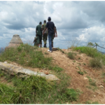
Thoppigala was not accessible for many years due to LTTE activities. it was a rendezvous point that they could control Polonnaruwa, Ampara and Batticalloa from there because of the significant Geo-position and formation of the rock. It is surrounded by broad planes, rivers, tanks and thick jungle and on the top of the rock, one could see so far around.

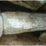
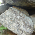
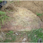
It also has some archaeologically important ruins of ancient Buddhist temple and a Pagoda
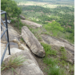
Cave remnants

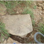
carving-less Sandakadapahana (moonstone)
Prof M. W. Wimal Wijeratne in his research has made a long description on the historical references written about this site such as; Sihalawaththuppakaranaya(4 A.D.), Sahassawaththuppakaranaya(10 A.D.), Rasawahiniya(13 A.D.) and Saddharmalankaraya(14 A.D.)
Read the complete article here– Thoppigala pdf